The Paznaun High Route


NIne stages, one adventure


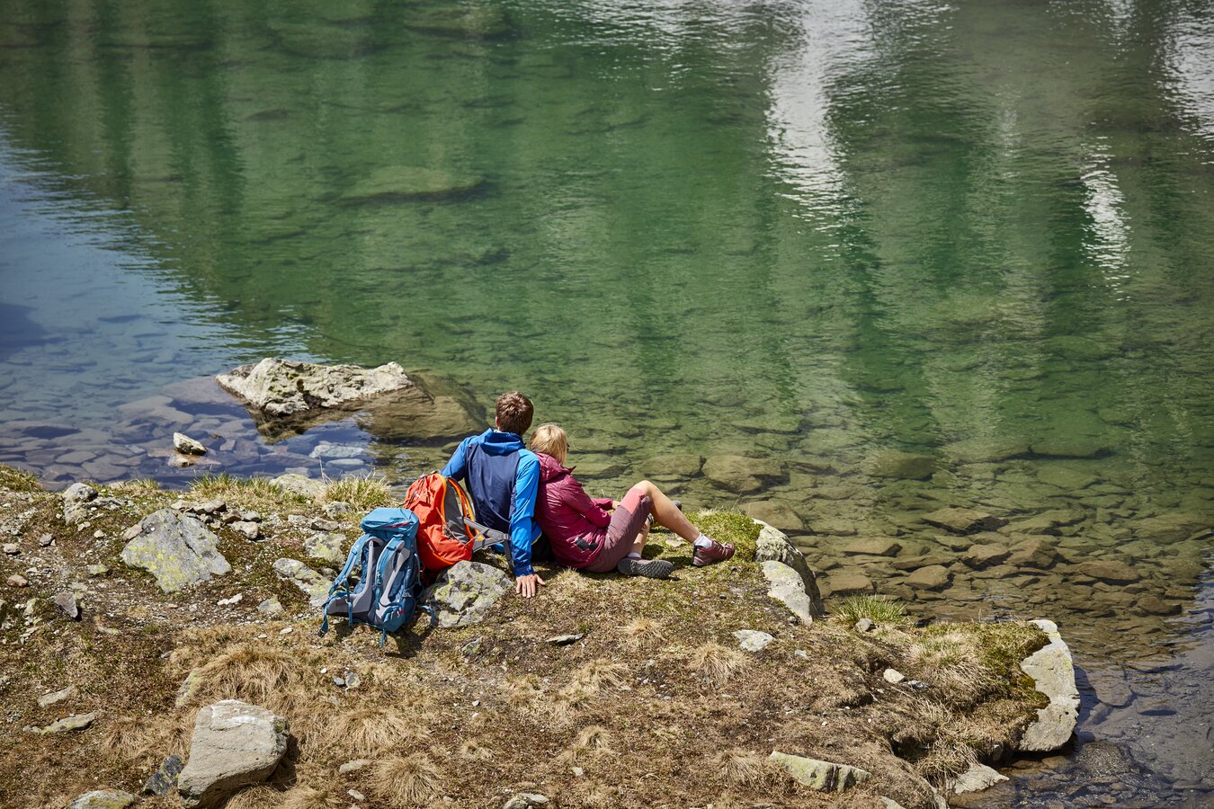
Varied trails and fascinating views of mountains and valleys: The Paznaun High Route is every hiking fan’s dream come true. The long-distance hiking trail is known for its great variety, making it popular with outdoor enthusiasts from all over the world.
The route takes you past lush green Alpine pastures, through the romantic larch forests of the Lower Paznaun Valley and up to high-alpine territory with steep and rocky sections. If you want to explore the Paznaun valley at your own pace, don’t miss this great opportunity to experience 130 kilometres of pure hiking bliss!


All Stages
Hikers can look forward to trails of varying characteristics and breathtaking panoramic views. The lush alpine meadows and romantic larch forests of the lower valley at the start of the trail will make your heart beat faster, as will the steep and rocky sections in the high alpine terrain of the upper valley. These lead past rugged peaks and rock formations and turn the trail into a real adventure.


Book a package
Discover the perfect package for the spectacular Paznaun High Route! The packages include overnight stays in the valley and on the mountain as well as an experienced guide for the planned stages.
You have the choice: a package for beginners with overnight stays in the valley and a hiking starter pack with everything you need, or the package for advanced hikers with overnight stays in the valley and on the mountain and the ascent of 6 stages (depending on the weather).
So go ahead, book now and start your adventure on the Paznaun High Route!
in alpine terrain
Easy Hiking Trails
...are relatively easy hiking & mountain trails that can be narrow and steep. There are no passages with a direct risk of falling.
Intermediate mountain Trails
...are predominantly narrow, often steep and can have passages where there is a risk of falling. There may also be short secured walking passages (e.g. wire rope).
Difficult mountain Trails
...are narrow, often steep and dangerous to fall down. There are frequent secured walking passages and/or easy climbing sections that require the use of hands. Surefootedness and a head for heights are essential.
- Only fit in the mountains and not just "fit through the mountains".
- No mountain hike without careful tour planning.
- Take the right equipment for the planned tour and nothing unnecessary.
- Obtain information about the tour and the weather conditions.
- Take a ten-minute break every two hours.
- Drink and eat plenty during the tour.
- Never leave the marked trail!
- Abort the tour in good time in the event of danger or deteriorating weather conditions.
- Emergency equipment (first aid kit, bivouac sack, torch, mobile phone) belongs in every rucksack.
- In an emergency, stay calm and call the mountain rescue service (Alpine emergency number 140).
- Secure injured persons from falling rocks, falls, avalanches, etc.
- First aid (breathing, circulation, haemostasis, splinting, etc.)
- Protect the injured person from the weather (wind, rain, sun, etc.)
- Never leave the injured person alone. Constant encouragement and support are essential for survival
Alpine distress signal: Repeat a visual or acoustic signal at regular intervals six times a minute - followed by a one-minute pause - until a response is detected.
If it is not possible to raise the alarm for help from the accident site: the signaller descends to fetch help - but never leave the injured person alone! If possible, do not descend alone.
Provide the reporter with the following data in writing: Exact location of the accident, type of injury, number of injured and uninjured group members. Leave unused warm clothing, rain protection and food with the injured person.
As the hiking area stretches across Switzerland, Vorarlberg and Tyrol, you will also encounter different signposting standards. All signs indicate the level of difficulty, destination, walking time and location information. But there are also other country-specific features:
| TYROL The Tyrolean signs also provide information about route numbers and can display further information using pictograms (e.g. restaurant) or themed routes. |
 |
| VORARLBERG Route separators between the destinations indicate turn-off destinations. The location number can be used to provide the exact location in an emergency. |
 |
| SWITZERLAND Different route destinations are subdivided with a route separator. Additional information using pictograms (e.g. railway station). Themed routes can be labelled with route fields. |
  |
Enjoy the marvellous variety of plants in our alpine nature, but please adhere strictly to the legal regulations on the protection of native flora. It is also your responsibility to ensure that no plant species is wiped out and lost for future generations.
| Under protection: | ||||
 |
 |
 |
 |
 |
| Snow rose | Fire lily | Edelweiss | Cochineal | Türkenbund |
 |
 |
 |
 |
|
| Innsbruck pasque flower | Spring pasque flower | Blue gentian | Long-tubed primrose |
|
Also protected are:
Yellow and black rue, blue and yellow marsh iris, dwarf alpine rose, stemless and glossy-leaved primrose, Baldo anemone, dragon's head, true speik and all alpine cushion and rosette plants.
A maximum of five pieces may be picked from:
Lily of the valley, large snowdrops or spring knot flowers, all columbine species, rock roses, platenigl, dwarf primrose and flour primrose, blue speick, cyclamen or cyclamen, white and yellow alpine anemone and narcissus anemone, all long-stemmed gentians, large-flowered and yellow foxglove.
At most, you may pick a hand bouquet of:
Stonecrop, spring cowslip, centaury, short-stemmed, blue-flowering gentian and alpine aster.
Provided that no damage is caused to the tree by cutting off branches, it is permitted to take a hand bouquet of Swiss stone pine branches.
Tip

The Paznaun
The Paznaun is much more than a simple Alpine valley. Nestled between the Verwall mountains, the Samnaun mountains and the Silvretta mountains, it offers an incredible variety of landscapes with fascinating geology, extraordinary flora and rich wildlife.
In addition to its impressive nature, Paznaun has a long history of colonisation by Rhaeto-Romanic and Walser people, who shaped its present-day culture and traditions. At the same time, the region developed into an important centre for tourism and alpinism, which today attracts outdoor enthusiasts from all over the world.
Whether exploring the unspoilt mountain landscape, observing rare animal species or searching for historical traces - Paznaun is a region full of beauty, history and adventure.


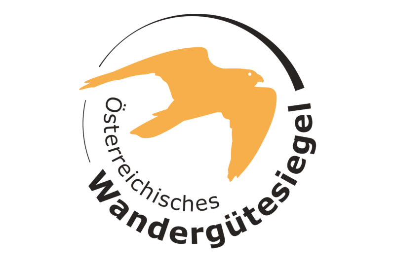
The Paznaun High Trail is certified with the Austrian Hiking Quality Seal
The Austrian Hiking Quality Seal stands for top-tier quality in hiking tourism. It certifies hiking trails, villages, and hosts that create a seamless experience and unforgettable outdoor adventures. The evaluation follows a comprehensive model, considering landscapes, visitor experience, navigation, and infrastructure.
But quality is not a one-time promise: Every four years, certified regions undergo on-site inspections to ensure high standards are maintained and continuously improved.
Certification is also a prerequisite for joining the Austrian Hiking Villages association, which includes over 40 top hiking destinations – from wild alpine landscapes to rolling vineyard hills. Each one is dedicated to the magic of walking, inviting visitors to explore Austria’s beauty step by step.
